Leica ULTRA (6011143) 5 Watt Precision Utility Tracing Standard Kit
- ManufacturerLeica
- Product Code: 6011143
- Availability: Pre-Order
-
Rp0
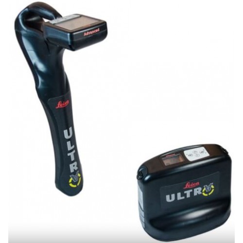
Leica ULTRA 5 Watt Precision Utility Tracing Standard Kit (Catalog 6011143)
5 Watt output power
Package with ULTRA Standard Locator, Standard Transmitter 5 Watt, ULTRA Signal Clamp, 125mm (5"), System Bag
Catalog number 6011143
The complexity of underground utility networks are continually increasing. So obtaining precise information on the location of buried utilities has never been more important. The protection of buried assets during excavation work demands accurate mapping and surveying of existing utilities.
The Leica ULTRA provides our most advanced precision utility tracing system. Intelligent signal processing has been integrated with unique flexible operating modes, to help save you time and increased confidence in your results. Selectable antenna and customized frequencies optimizes your instrument for site specific applications, supported by our AIM system which monitors signal interference levels, recommending which mode to use for the best results.
Optimized Specifically for Utility Tracing
Configuration for challenging environments
Optimize the instrument to overcome the most challenging and complex site conditions. The Leica ULTRA locator can be configured for different project environments and has more than 100 programmable operating frequencies available. Program modes can adapt the antennas to deliver improved accuracy and repeatability.
Trace utilities through any obstruction
There will always be an occasion when the utility runs close to or underneath an obstruction. With Offset Measuring, the Leica ULTRA locates the target line if not directly accessible from above. The function uses the available data to estimate the horizontal and vertical (depth) distance.
Clear operational display
Clear graphical LCD screen, with auto-pinpointing directional arrows. Ensure confident and fast tracing in all operating conditions, day or night, with the large backlit display.
GNSS & GIS integration
True one man, single-step data capture solution for buried utility mapping or surveying applications. Leica ULTRA integrates with GNSS or GIS data capture devices.
Unlock the Power
Configure the Leica ULTRA for site specific applications. Custom build your receiver and transmitter.
Choose from over 100 preselected frequencies, or customise your own frequency for highly specialised applications.
Automatically capture the instruments location data to ensure adherence to best practice. The data logging feature allows the user to record external GPS coordinates and download with the datafile as a KML or CSV format. Upload into GIS systems or Google Maps to confirm where, when and how the work was performed.
In The Box
- ULTRA Standard Locator (818699)
- Standard Transmitter 5 Watt (818702)
- ULTRA Signal Clamp, 125mm (5") (818704)
- ULTRA System Bag (818706)
- ULTRA System Quick Guide (841158)
- ULTRA System User Manual (841205)
Related Products


 12 Watt Precision Utility Tracing Standard Kit")

Tags: Utility Tracing

 info@indometer.co.id
 DKI Jakarta-Indonesia